
The Centibots system is a framework for very large teams of robots
that are able to perceive, explore, plan and collaborate in unknown
environments. The Centibots were developed in collaboration with SRI International, funded under
DARPA's SDR program. The Centibots team currently consists of
approximately 100 robots. These robots can be deployed in unexplored
areas, and can efficiently distribute tasks among themselves; the
system also makes use of a mixed initiative mode of interaction in
which a user can influence missions as necessary.
Our research group focused on the problem of distributed mapping and exploration. In the mapping phase, multiple robots explore the environment in order to build a map that can be used in the subsequent search and surveillance phases. We developed a decentralized system that goes beyond the state of the art in multi-robot mapping in that it does not depend on reliable communication between robots and makes no assumptions about the robots' relative start locations. Below are some results obtained during the final demo (see also the SRI centibots web site).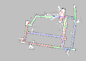
Click on the image to see three of our robots as they build a map of the Allen Center (shown is the perspective of the blue robot).
The animation might not look correct for about 7 seconds.
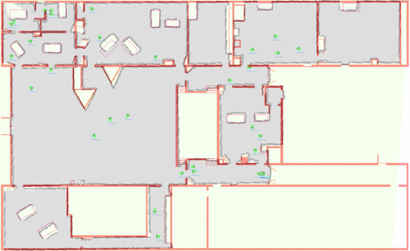
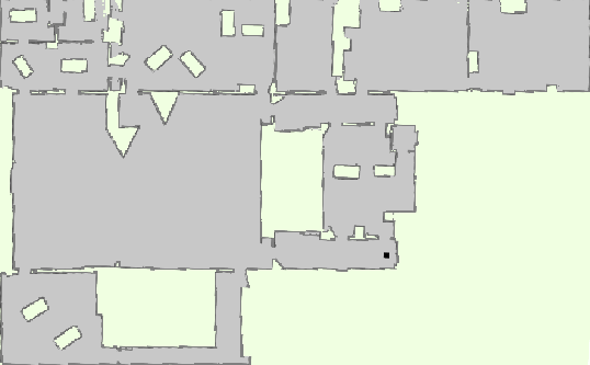
One of the maps built during the evaluation overlaid with manually generated ground truth map (click on image for large version).
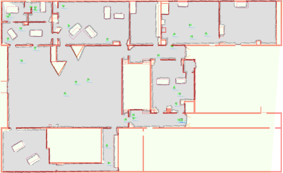
Three maps built during different runs, under different circumstances. The fact that the maps are virtually identical confirms our belief that these maps are more accurate than the manually generated ground truth map.
Our research group focused on the problem of distributed mapping and exploration. In the mapping phase, multiple robots explore the environment in order to build a map that can be used in the subsequent search and surveillance phases. We developed a decentralized system that goes beyond the state of the art in multi-robot mapping in that it does not depend on reliable communication between robots and makes no assumptions about the robots' relative start locations. Below are some results obtained during the final demo (see also the SRI centibots web site).
Mapping Example
Click on the image to see three of our robots as they build a map of the Allen Center (shown is the perspective of the blue robot).
The animation might not look correct for about 7 seconds.
Results from the Final Project Evaluation in Fort APHill, 01/2004
The evaluation of the Centibots system is described in the Proc. of the IEEE 2006 paper "Distributed Multi-Robot Exploration and Mapping". Our coordination strategy is discussed in an IROS-03 paper. We also developed a hierarchical Bayesian technique for the map merging problem; see our ISRR-03 and UAI-03 papers.
One of the maps built during the evaluation overlaid with manually generated ground truth map (click on image for large version).
 |
 |
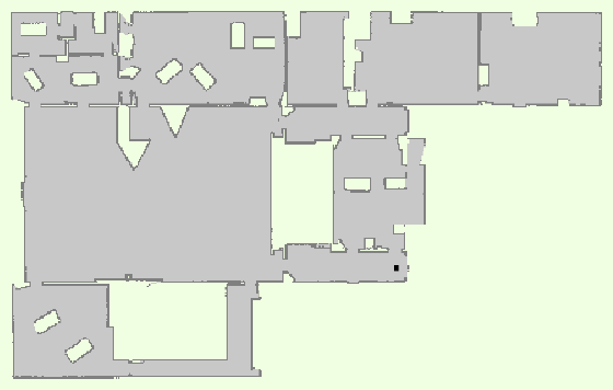 |
Three maps built during different runs, under different circumstances. The fact that the maps are virtually identical confirms our belief that these maps are more accurate than the manually generated ground truth map.
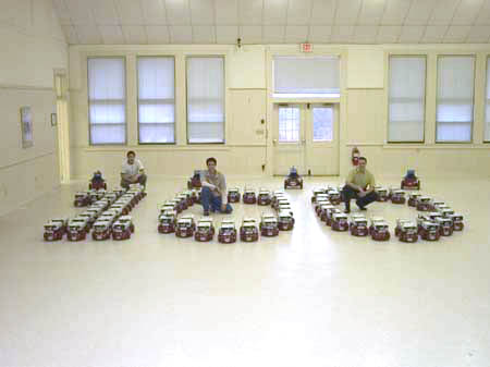
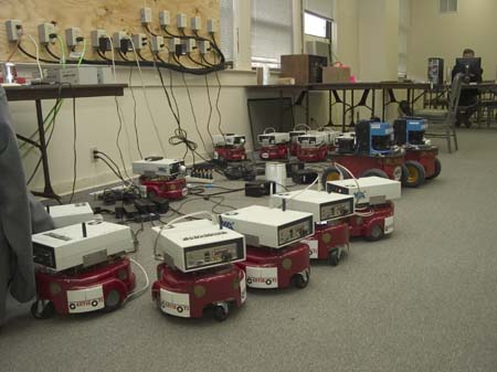
Some Pictures
 |
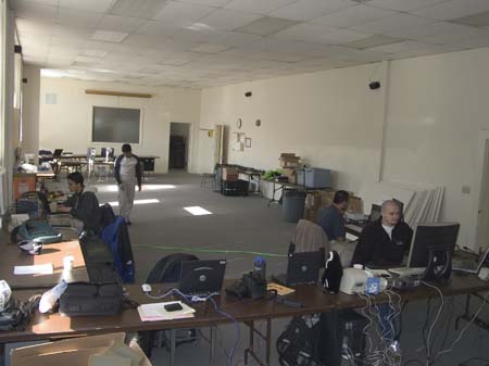 |
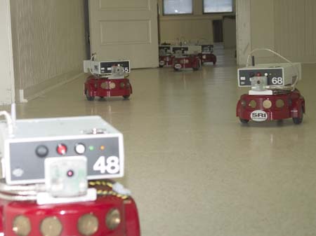
| Amigobots on the loose | Command center during final demo |
 |
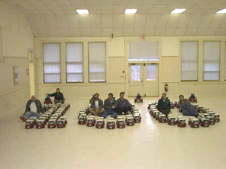 |
| UW development team | Developers united |
 |
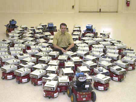 |
| Robots taking a break | Our fearless leader |